

TL;DR:
- A legal property description precisely defines a land parcel using systems like Metes and Bounds, Lot and Block, or the Rectangular Survey System. It is essential for deeds, title insurance, and court cases, and cannot be replaced by address or parcel number. Correcting description issues before closing saves time and money, ensuring clear title and proper financing.
A legal property description is the precise, recorded text that defines a parcel of land for deeds, title insurance, mortgages, easements, and court adjudication. It is not your street address. It is not your tax parcel number. It is a self-contained set of instructions that lets a licensed surveyor locate your exact boundaries using only that text and public records — nothing else.
Three systems accomplish this in the United States:
- Metes & Bounds — traces a parcel's perimeter using compass bearings, distances, and physical monuments; standard in the original eastern and southern states
- Lot & Block (Recorded Plat) — references a recorded subdivision map filed with the county recorder; common in urban and suburban areas nationwide
- Rectangular Survey System (PLSS) — the Public Land Survey System divides land into townships, ranges, and sections; predominant west of the Appalachians and across most of the rural West
Every metes & bounds description anchors to a Point of Beginning (POB), a fixed, identifiable monument on the ground. The National Geodetic Survey (NOAA) maintains geodetic control marks that surveyors tie to for precision. Transaction safeguards that depend on an accurate description include the recorded deed, the title commitment, the survey plat, county recorder records, and title insurance. Increaltors works with buyers and sellers across Southern California to make sure these documents align before any deal closes.
Table of Contents
- What a legal description actually is — and why your address isn't enough
- The three U.S. land-description systems and when each one applies
- Why the Point of Beginning matters more than most buyers realize
- How property descriptions move through a real estate transaction
- Who can prepare a legal description — and who should
- What makes a legal description valid and complete
- Common problems with property descriptions and their legal consequences
- Best practices for buyers, sellers, and agents before closing
- How long it takes and what it costs to get or correct a description
- Pre-closing checklist: practical steps every buyer and seller should take
- Key Takeaways
- Why legal descriptions deserve more attention than they usually get
- Working with a local agent who knows the details
- Authoritative sources and where to look next
What a legal description actually is — and why your address isn't enough
A legal description is self-contained instructions that allow a surveyor to locate a parcel using only the description and publicly recorded documents. No phone calls. No context from the seller. No guessing. If a surveyor cannot reconstruct the parcel from those words alone, the description has failed its primary legal purpose.
Street addresses are assigned by municipalities for mail delivery and emergency services. Assessor Parcel Numbers (APNs) are tax administration tools. Neither one is legally sufficient for conveyance or court use because they can change, get reassigned, or simply not correspond to a surveyed boundary. A deed that relies on an address instead of a proper legal description risks being unenforceable.
Here is what a metes & bounds call looks like in practice:
Compare that to a lot-and-block shorthand: "Lot 14, Block 7, Sunset Hills Subdivision, as recorded in Plat Book 22, Page 18, Los Angeles County, California." Both are legally sufficient. Both are useless without the recorded plat or survey behind them.
Pro Tip: Always attach the recorded plat or the most recent licensed survey as an exhibit to your purchase contract. Referencing "the property at 123 Main Street" in a contract is an invitation to a dispute.
The three U.S. land-description systems and when each one applies
Understanding which system governs your parcel tells you exactly what documents to pull, what a surveyor will need, and where problems are most likely to hide.
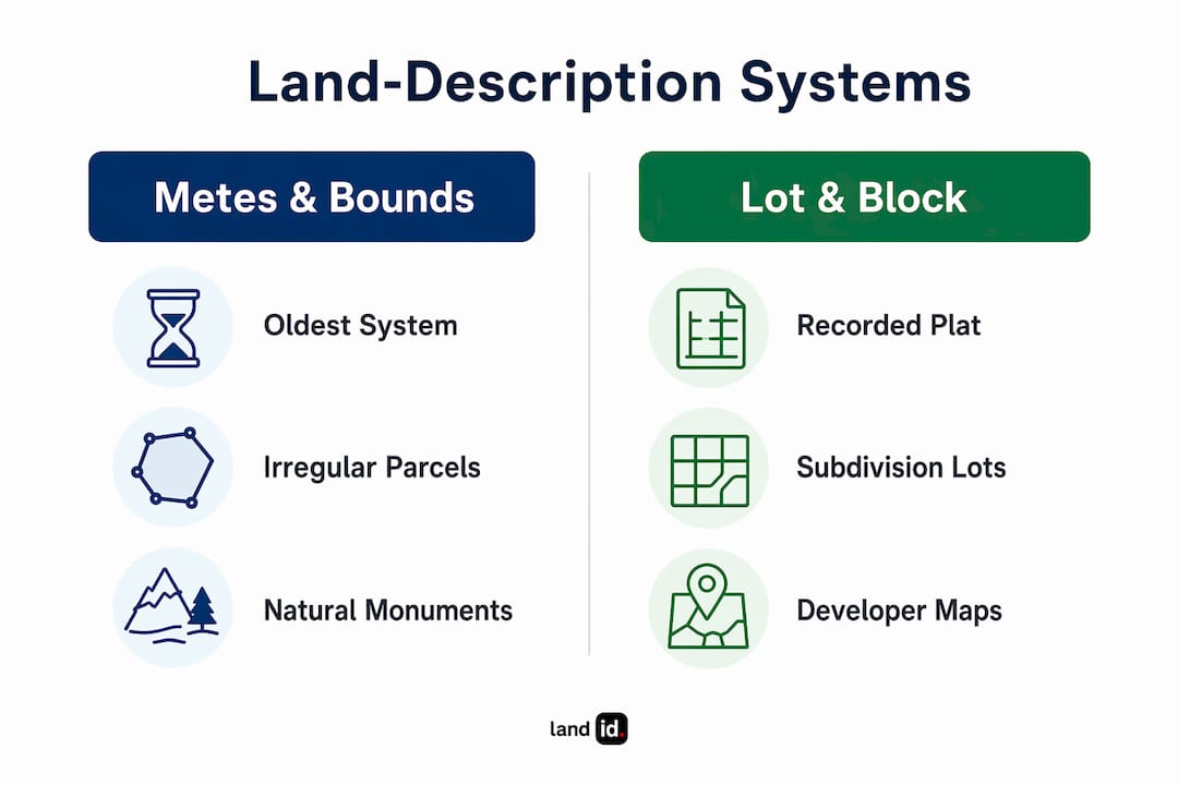
Metes & Bounds
This is the oldest system in the country, predating the federal rectangular grid. A metes & bounds description walks the boundary of a parcel in sequence, starting and ending at the POB. Each "call" states a bearing (compass direction) and a distance, then references a monument. The description must mathematically close, meaning the final leg returns precisely to the POB. When it does not, surveyors call it a closure error, and even a small discrepancy in bearing or distance can shift a boundary line by several feet on the ground, creating encroachments or gaps between neighboring parcels.
Metes & bounds is standard in roughly 20 eastern and southern states and is also used for irregular parcels anywhere in the country that fall outside the rectangular grid.
Lot & Block (Recorded Plat)
When a developer subdivides land, they record a plat map with the county recorder. That map assigns lot and block numbers to every parcel. The recorded plat must comply with local surveying standards, and the full legal description typically reads: lot number, block number, subdivision name, plat book and page, county, and state. This system is the most common one you will encounter in Southern California subdivisions and urban areas nationwide.
Rectangular Survey System (PLSS)
Congress established the Public Land Survey System in 1785 to divide the public domain into a grid of townships (6 miles square) and sections (1 mile square, 640 acres). A PLSS description reads something like: "The NW¼ of the SE¼ of Section 12, Township 3 North, Range 5 East, San Bernardino Meridian." This system covers most land west of the Appalachians and is the dominant method across rural California, Nevada, Arizona, and the broader West.
| System | Typical geography | How the parcel is referenced | Key documentary evidence | Common pitfalls |
|---|---|---|---|---|
| Metes & Bounds | Eastern/southern states; irregular parcels | Bearings, distances, monuments from a POB | Survey plat, field notes, deed calls | Closure errors, missing monuments, obsolete references |
| Lot & Block | Urban/suburban subdivisions nationwide | Lot number, block, plat book/page | Recorded plat map, county recorder | Plat not recorded, lot renumbering, easements not shown |
| PLSS | Rural/western U.S. | Township, range, section, fraction | BLM cadastral survey, section corner records | Fractional sections, overlapping grants, missing corner monuments |
For reading and interpreting any of these systems, the first step is identifying which one applies — then following its format to locate the key reference documents.
Why the Point of Beginning matters more than most buyers realize
The POB is the fixed, identifiable spot where a metes & bounds boundary description starts and ends. It anchors the entire description to the physical world. A surveyor might use a driven iron pin, a concrete monument, or a natural feature like a rock ledge. Whatever it is, the point must be specific enough that anyone can find it on the ground without ambiguity.
Surveyors often distinguish between the Point of Commencement (POC) and the POB. The POC is a well-known, publicly recorded corner (often a government corner from the PLSS or a National Geodetic Survey control mark) from which the surveyor travels to reach the POB. The POC provides an independent tie to the public record, making the description far more durable over time.
"The ambiguous descriptions of the past are the boundary disputes of the future." — Bureau of Land Management, Specifications for Descriptions of Land
When a POB monument is missing or destroyed, the description can become unlocatable. The parcel cannot be reliably reconstructed, which means title insurers will refuse to issue a policy, lenders will not fund, and the only remedies are a corrective survey, a corrective deed, or quiet-title litigation.
The priority of calls hierarchy governs disputes when elements conflict: natural monuments rank first, artificial monuments second, distances third, bearings fourth, and stated acreage last. Acreage is arithmetic derived from the other elements — if the boundary lines are wrong, the acreage figure is meaningless.
Pro Tip: When a deed ties its POB to a recorded monument (an iron pin set in a plat, a BLM corner), that description is far harder to challenge decades later than one referencing a tree or a fence post.
How property descriptions move through a real estate transaction
Every stage of a U.S. property transaction touches the legal description. Here is where it appears and what each party needs to see:
At contract: The purchase agreement should include the complete legal description from the seller's existing deed or attach a survey as an exhibit. Courts have ruled that contracts without an adequate property description can fail for lack of a definite parcel. If the description is not yet available, make the contract contingent on a survey and title review.
At title commitment: The title company issues a commitment with Schedule A (which states the legal description) and Schedule B (which lists exceptions). The description in Schedule A must match the deed exactly. Any discrepancy here is a red flag that needs resolution before closing.

At the lender: The mortgage or deed of trust incorporates the legal description to attach the lien to the correct parcel. Lenders require this to confirm the collateral is what the borrower claims it is.
At closing and recording: The deed executed at closing carries the legal description, and that deed is recorded with the county recorder's office. Recording gives the world constructive notice of the transfer.
Key documents that must carry identical descriptions:
- Purchase contract (or attached survey exhibit)
- Title commitment Schedule A
- Survey or plat
- Deed
- Mortgage or deed of trust
- Any recorded easement
Title insurance attaches coverage to the described parcel. A clouded or ambiguous description can block funding entirely until the defect is corrected. For buyers reviewing real estate disclosures, confirming the legal description matches across all documents is one of the most important steps before signing.
Who can prepare a legal description — and who should
Not everyone who touches a real estate transaction is qualified to write or certify a legal description.
Licensed land surveyors are the only professionals who can create and certify a new metes & bounds description or a subdivision plat. Surveying is a licensed profession in every U.S. state, and survey documents carry the surveyor's professional stamp and license number. A description prepared without that certification carries no legal weight for recording purposes. Surveyors' certifications and monuments give descriptions practical, court-acceptable force.
Real estate attorneys draft the deed language that incorporates the description, handle easement documents, and manage corrective deeds or quiet-title actions when a description is defective. An attorney does not create the technical survey — they work from the surveyor's certified description to prepare the legal instrument.
Title examiners extract the recorded description from prior deeds and confirm it appears correctly in the title commitment. They identify gaps, overlaps, or inconsistencies in the chain of title.
Real estate agents and buyers should never attempt to write or modify a metes & bounds description themselves. Verify a surveyor's credentials through your state's licensing board and confirm the survey document carries a professional stamp. For complex situations — boundary disputes, easement drafting, or corrective deeds — involve a real estate attorney early.
Pro Tip: Ask the title officer to confirm which prior deed they pulled the Schedule A description from. If it traces back more than one or two transfers, request a licensed surveyor's confirmation that the description still matches the physical monuments on the ground.
What makes a legal description valid and complete
A legally sufficient description must contain enough information for a surveyor to locate the parcel from the text and public records alone. The essential elements vary by system, but across all three, a complete description includes:
- Jurisdiction — county and state (sometimes city or township)
- System reference — POB and perimeter calls (metes & bounds), or lot/block/plat book/page (lot & block), or section/township/range/principal meridian (PLSS)
- Bearings and distances — for metes & bounds, each call states a compass bearing and a measured distance
- Monument references — named physical markers that anchor the description to the ground
- Exceptions and easements — any portion excluded from the conveyance or subject to a recorded easement
- Acreage statement — included as a reference, not a controlling element
"The definition of a legally sufficient real property description is one that can be located on the ground by a land surveyor." — Bureau of Land Management, Specifications for Descriptions of Land
Acreage deserves a specific note. Many buyers focus on the stated acreage as if it controls the transaction. It does not. Acreage ranks last in the priority of calls hierarchy. If the boundary calls produce a parcel of 0.48 acres but the deed states 0.50 acres, the boundary calls govern. Before closing, verify the deed description against the title commitment and the survey — all three should reflect the same parcel.
Common problems with property descriptions and their legal consequences
Description defects are more common than most buyers expect, and the consequences range from a delayed closing to a failed transaction to years of litigation.
Closure errors occur when a metes & bounds description's perimeter calls do not mathematically return to the POB. Even a small transcription error in a bearing or distance can shift a boundary line by several feet, creating an encroachment on a neighbor's property or a gap of unowned land between parcels. Surveyors flag closure errors during their review, but older deeds often contain them undetected.
Missing or destroyed monuments leave the description without a physical anchor. When the iron pin or concrete monument referenced as the POB has been removed or buried, a surveyor cannot reliably reconstruct the boundary without additional fieldwork and research.
Obsolete references appear in older deeds that tie boundaries to features that no longer exist — a tree that was cut down, a road that was vacated, a creek that changed course. These references make the description ambiguous and can describe multiple possible locations.
Gaps and overlaps arise when neighboring parcels were described from different directions over the years. A gap leaves a sliver of land with no clear owner. An overlap means two deeds claim the same strip of ground.
Legal consequences of these defects include:
- Title insurer refusal to issue a policy until the defect is corrected
- Lender refusal to fund the mortgage
- Delayed or cancelled closing
- Corrective deed required (minor math errors)
- Quiet-title lawsuit required (competing claims or destroyed monuments)
Courts will try to uphold imperfect descriptions when the parties' intent is clear, but when a surveyor cannot reconstruct the parcel from the description and public records, the contract may fail entirely. A practical case: a POB mismatch discovered during title review halted a sale in escrow, requiring a corrective survey, a corrective deed, and re-recording before the lender would fund — adding weeks and several hundred dollars in fees to the closing timeline.
Best practices for buyers, sellers, and agents before closing
Getting ahead of description problems is far cheaper than resolving them after a deal falls apart. Here are the steps that matter most:
- Obtain a current licensed survey. For any property where the last survey is more than a few years old, or where the parcel has irregular boundaries, commission a new boundary survey before signing.
- Attach the recorded plat or survey as a contract exhibit. Do not rely on a street address or APN in the purchase agreement. Use the full legal description from the seller's deed or the survey.
- Compare the survey, deed, and title commitment. All three must describe the same parcel. Any discrepancy needs to be resolved before closing, not after.
- Require title insurance. A title policy protects against defects that were not discovered during the transaction. Without it, a boundary problem that surfaces years later falls entirely on the buyer.
- Build in a survey contingency. If a current survey is not available at contract, make the agreement contingent on a satisfactory survey and title review.
- Involve the title officer early. If you spot a discrepancy between the deed and the title commitment, flag it immediately. Title officers can often resolve minor issues quickly; major defects take longer.
For buyers and borrowers, confirming that the legal description in the mortgage matches the deed is a step that protects your financing from day one.
Pro Tip: For older properties in mixed-description jurisdictions — where a parcel might carry both PLSS and metes & bounds references — require a surveyor's written confirmation that the boundary monuments are still in place and locatable before you close.
How long it takes and what it costs to get or correct a description
Timing and cost vary significantly depending on what you need and how complex the parcel is.
Routine plat retrieval from the county recorder typically takes one to three business days. Most counties now offer online access to recorded plat books, so this step is often same-day.
A standard boundary survey for a residential lot in Southern California generally takes one to three weeks from order to delivery, depending on surveyor availability and how much historical research is required. Rural or irregular parcels take longer.
Corrective work — re-establishing a missing monument, preparing a corrective deed, or resolving a minor closure error — commonly runs in the $500–$2,000 range for straightforward cases. Complex situations involving competing claims, destroyed monuments across multiple parcels, or quiet-title litigation can be much more expensive.
Survey cost callout: Routine corrective survey and deed work typically falls in a range consistent with common professional fees for straightforward cases. Quiet-title litigation can run into the tens of thousands of dollars. Catching a description problem before closing is almost always the less expensive path.
When timing a sale, build survey and title review time into your schedule early. Waiting until the week before closing to discover a description defect is the most common way to lose a buyer.
- Request written estimates from at least two licensed surveyors before ordering work
- Confirm with the title company which survey deliverables they require (some require an ALTA/NSPS survey for commercial or complex residential transactions)
- Ask whether the lender has specific survey requirements before ordering
Pre-closing checklist: practical steps every buyer and seller should take
This checklist reflects the guidance of licensed surveyors, real estate attorneys, and title professionals. Work through it before you sign anything.
- Verify the deed's full legal description. Pull the current recorded deed from the county recorder and confirm the description is complete, legible, and matches the system (metes & bounds, lot & block, or PLSS) appropriate for the parcel.
- Attach the recorded plat or signed survey as a contract exhibit. Never let the purchase agreement reference only an address or APN.
- Confirm the title commitment's Schedule A matches the deed and survey exactly. Any variation — even a transposed number — needs to be corrected before closing.
- Require lender acceptance of the survey. Some lenders have specific survey requirements; confirm these early so the survey can be ordered in time.
- Secure title insurance. Both lender's and owner's policies protect against defects that survive the closing process.
- Hire a licensed land surveyor for any metes & bounds or complex parcel. Verify their state license and confirm the survey document carries their professional stamp.
- Consult a real estate attorney if the description is ambiguous, disputed, or requires a corrective deed. Do not attempt to resolve boundary or easement issues without legal counsel.
For vetting listings in Southern California, this checklist pairs directly with the due-diligence steps that protect buyers from costly surprises after closing.
Pro Tip: Involve the title officer at the same time you order the survey — not after. Title officers can flag description issues in the chain of title that the surveyor needs to know about before fieldwork begins.
This article is general information, not legal advice. Confirm current requirements with a licensed surveyor, real estate attorney, or title professional for your specific transaction.
Key Takeaways
A legal property description is the only document that definitively identifies a parcel for deeds, title insurance, and courts — and getting it right before closing prevents the most expensive problems in real estate.
| Point | Details |
|---|---|
| Legal descriptions are legally binding | Only a proper legal description — not an address or APN — is sufficient for deeds, mortgages, and court use. |
| Three systems cover all U.S. parcels | Metes & Bounds, Lot & Block, and PLSS each apply to different geographies; knowing which one governs your parcel determines what documents you need. |
| POB problems can kill a deal | A missing or destroyed Point of Beginning can make a description unlocatable, blocking title insurance and lender funding until corrected. |
| Corrective work has a real cost | Routine corrective survey and deed work typically runs $500–$2,000; quiet-title litigation costs far more — catch issues before closing. |
| Increaltors coordinates the process | Working with Increaltors in Southern California means your agent helps align the survey, title commitment, and deed before any deal closes. |
Why legal descriptions deserve more attention than they usually get
Most buyers and sellers treat the legal description as administrative fine print — something the title company handles automatically. That assumption is where problems start.
In Southern California, where parcels range from newer tract-home subdivisions with clean lot-and-block references to older hillside properties with metes & bounds descriptions tied to monuments that have not been verified in decades, the gap between a clean description and a problematic one can mean the difference between a smooth 30-day close and a transaction that stalls in escrow for months. Mixed-system parcels — where a PLSS reference and a metes & bounds call appear in the same deed — are more common here than most buyers realize, and they require a surveyor who knows both systems.
The deeper issue is that description errors compound over time. A small closure error in a 1960s deed gets copied into every subsequent deed. By the time a buyer discovers it in 2026, the boundary has been "wrong" for 60 years, and correcting it may require tracking down heirs of the original grantor. Treating the legal description as a core transaction document — not an afterthought — is the single most effective way to protect your investment.
Working with a local agent who knows the details
When a property description issue surfaces during a transaction, having a knowledgeable local agent in your corner makes a real difference. Increaltors, based in the Los Angeles and Orange County markets, coordinates directly with licensed surveyors, title officers, and real estate attorneys to identify and resolve description problems before they delay or derail a closing.

Whether you are buying a single-family home, exploring vacant land where survey work is especially critical, or simply want a professional review of your transaction documents, Increaltors brings the local expertise and professional network to get it done right. Reach out to Irvin Nierras directly through increaltors.com to discuss your transaction and get connected with the right professionals for your specific parcel.
Authoritative sources and where to look next
These are the primary references professionals use when working with legal descriptions. Each one serves a different purpose in the research and verification process.
| Source | What it contains | Why it matters |
|---|---|---|
| County Recorder / Recorder of Deeds | Recorded deeds, plat books, easements, corrective deeds | Primary source for the current legal description and chain of title |
| Title commitment (Schedule A/B) | Legal description, ownership history, exceptions | Shows how the title company has identified the parcel and what is excluded from coverage |
| Licensed land surveyor report | Certified boundary survey with professional stamp | The authoritative field document for metes & bounds and complex parcels |
| BLM Cadastral Survey / PLSS records | Township, range, section corner data | Essential for rural and western parcels; BLM land descriptions set the federal standard |
| National Geodetic Survey (NOAA) | Geodetic control marks and benchmarks | Provides the fixed reference points surveyors tie to for precision |
| Recorded subdivision plat | Lot and block assignments, easements, dimensions | Required for any lot-and-block description; found at the county recorder |
- At the county recorder, ask for the plat book and page number, the most recently recorded deed, and any recorded easements affecting the parcel
- From the title company, request Schedule A (description) and Schedule B (exceptions) of the title commitment
- From your surveyor, confirm the report carries a professional stamp and references the recorded plat or BLM corner as a tie point
- For PLSS parcels, the BLM's General Land Office Records portal provides original survey field notes and plat maps at no cost